|
|
--- |
|
|
dataset_info: |
|
|
features: |
|
|
- name: image |
|
|
dtype: image |
|
|
- name: metadata |
|
|
dtype: string |
|
|
splits: |
|
|
- name: train |
|
|
num_bytes: 6174743543.802 |
|
|
num_examples: 1142 |
|
|
download_size: 6408762030 |
|
|
dataset_size: 6174743543.802 |
|
|
configs: |
|
|
- config_name: default |
|
|
data_files: |
|
|
- split: train |
|
|
path: data/train-* |
|
|
--- |
|
|
|
|
|
|
|
|
# GeoBench (GeoVista Bench) |
|
|
|
|
|
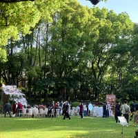
GeoBench is a collection of real-world panoramas with rich metadata for evaluating geolocation models. Each sample corresponds to one panorama identified by its `uid` and includes both the original high-resolution imagery and a lightweight preview for rapid inspection. |
|
|
|
|
|
## Dataset Structure |
|
|
|
|
|
- `id`: unique identifier (same as `uid` from the original data). |
|
|
- `raw_image_path`: relative path (within this repo) to the source panorama under `raw_image/<uid>/`. |
|
|
- `preview`: compressed JPEG preview (<=1M pixels) under `preview_image/<uid>/`. This is used by HF Dataset Viewer. |
|
|
- `metadata`: JSON object storing capture timestamp, location, pano_id, city, and other attributes. Downstream users can parse it to obtain lat/lng, city names, multi-level location tags, etc. |
|
|
- `data_type`: string describing the imagery type. If absent in metadata it defaults to `panorama`. |
|
|
|
|
|
All samples are stored in a Hugging Face-compatible parquet file at `data/<split>/data-00000-of-00001.parquet`, with additional metadata in `dataset_info.json`. |
|
|
|
|
|
## Working with GeoBench |
|
|
|
|
|
1. Clone/download this folder (or pull it via `huggingface_hub`). |
|
|
2. Load the parquet file using Python: |
|
|
```python |
|
|
from datasets import load_dataset |
|
|
|
|
|
ds = load_dataset('path/to/this/folder', split='train') |
|
|
sample = ds[0] |
|
|
`` |
|
|
`sample["preview"]` loads directly as a PIL image; `sample["raw_image_path"]` points to the higher-quality file if needed. |
|
|
3. Use the metadata to drive evaluation logic, e.g., compute city-level accuracy, filter by `data_type`, or inspect specific regions. |
|
|
|
|
|
## Notes |
|
|
|
|
|
- Raw panoramas retain original filenames to preserve provenance. |
|
|
- Preview images are resized to reduce storage costs while remaining representative of the scene. |
|
|
- Ensure you comply with the dataset’s license (`dataset_info.json`) when sharing or modifying derived works. |
|
|
|
|
|
## Related Resources |
|
|
|
|
|
• GeoVista model (RL-trained agentic VLM used in the paper): |
|
|
https://huggingface.co/LibraTree/GeoVista |
|
|
• GeoVista-Bench (previewable variant): |
|
|
A companion dataset with resized JPEG previews intended to make image preview easier in the Hugging Face dataset viewer: |
|
|
https://huggingface.co/datasets/LibraTree/GeoVistaBench |
|
|
(Same underlying benchmark; different packaging / image formats.) |
|
|
• Paper page on Hugging Face: |
|
|
https://huggingface.co/papers/2511.15705 |
|
|
|
|
|
|
|
|
## Citation |
|
|
``` |
|
|
@misc{wang2025geovistawebaugmentedagenticvisual, |
|
|
title = {GeoVista: Web-Augmented Agentic Visual Reasoning for Geolocalization}, |
|
|
author = {Yikun Wang and Zuyan Liu and Ziyi Wang and Pengfei Liu and Han Hu and Yongming Rao}, |
|
|
year = {2025}, |
|
|
eprint = {2511.15705}, |
|
|
archivePrefix= {arXiv}, |
|
|
primaryClass = {cs.CV}, |
|
|
url = {https://arxiv.org/abs/2511.15705}, |
|
|
} |
|
|
``` |
|
|
|